Airfield search
Thetford (Snarehill)


| Also known as: | RAF Thetford / RFC Thetford / Thetford Aerodrome |
| County: | Norfolk |
| Current Status: | Farmland / Open land |
| Date: | November 1915 - September 1920; (decoy) 20 March 1940 (approx) - closed by 12 August 1942 |
| Current Use: | Disused |
| Used By: | RAF / RFC |
| Landing Surface Type(s): | Unpaved |
| Aircraft Role(s): | Trainer |
| Decoy Type(s): | KQ, to Q by 15 December 1941 |
| Decoy Number(s): | 28(a) |
The following organisations are either based at, use and/or have at least potentially significant connections with the airfield (as at 01/09/2011):
- Brettenham and Kilverstone Parish Council
- Thetford Library
- Thetford Town Council
Main unit(s) present:
-
No 4 School of (Aerial) Navigation and Bomb-Dropping
-
8th Aero Sqn
-
No 12 RAS
-
No 12 RS
-
No 12 TS
-
No 15 RAS
-
23rd Aero Sqn
-
No 25 RS
-
No 25 Sqn
- No 25 TS
-
No 35 Sqn
-
No 35 TDS
- No 38 Sqn
- No 45 Sqn
-
No 51 Sqn
-
No 73 TS
- No 77 Sqn
- No 80 Sqn
- No 119 Sqn
-
No 128 Sqn

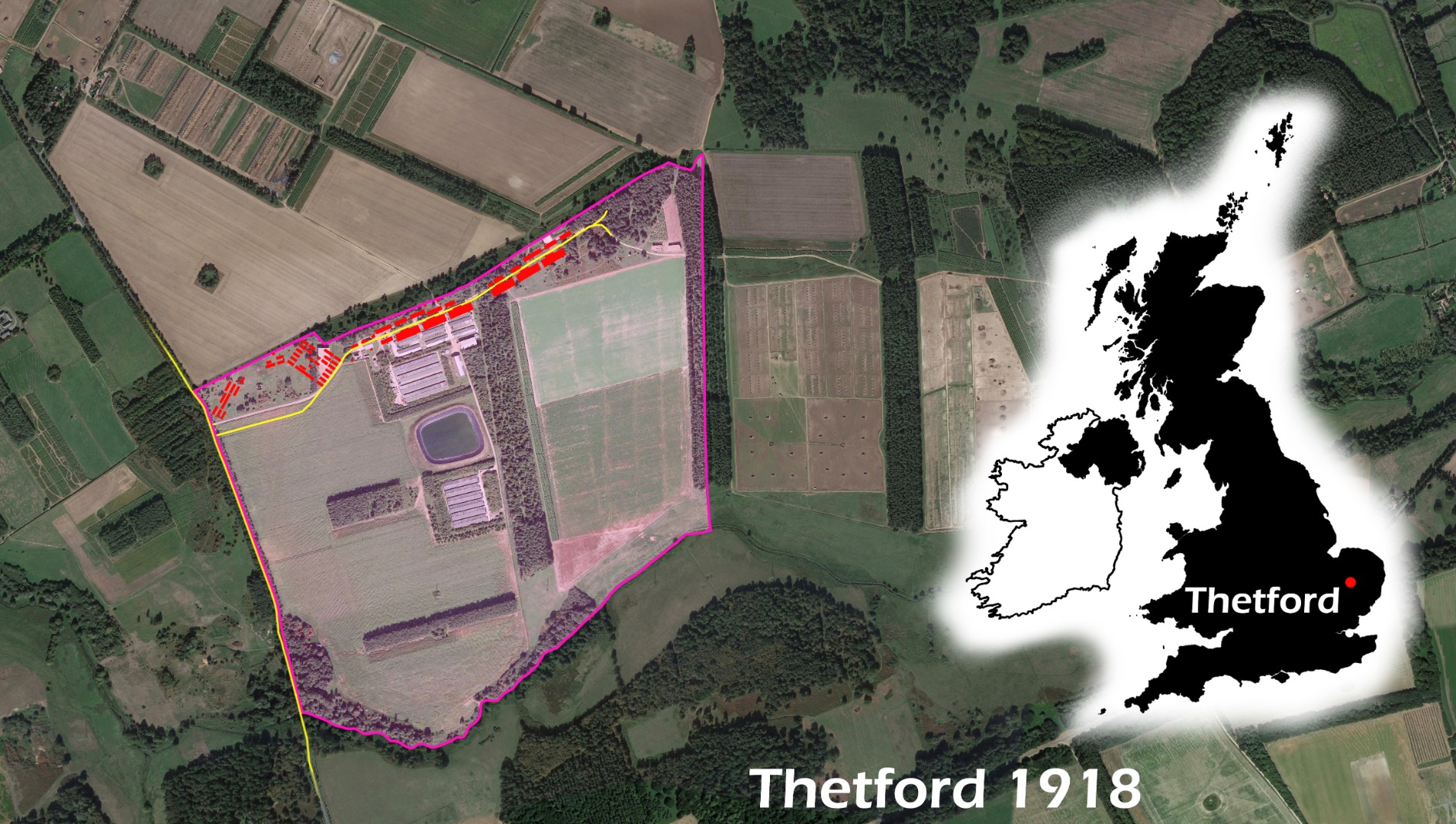
Plan of Thetford, 1918. Courtesy of Ed Andrews
| Parent(s)/HQ Airfield(s): | |
| Home Defence Flight Station(s): | |
| Associated Airfield(s): |