Bourn
| Also known as: | Bourn Aerodrome / Bourn Market / Bourn Quarter / Bourne (misspelling) / RAF Bourn / RAF Station, Bourn |
| County: | Cambridgeshire |
| Current Status: | Farmland (main position) / Housing (proposed main position) / Industry |
| Date: | 1941 (earliest known date April) - 2020 |
| Current Use: | Disused |
| Used By: | RAF / Civil |
| Landing Surface Types: | Paved |
| Aircraft Roles: | Aircraft modification/repair / Bomber (main role) / Fighter / General aviation (main role) / Meteorological reconnaissance / Trainer |
The following organisations are either based at, use and/or have at least potentially significant connections with the airfield (as at 01/09/2011):
- Bourn Parish Council
- Caldecote Local History Group
- Caldecote Parish Council
- Cambourne Parish Council
- Eurorider Training
- R. Taylor & Sons
- Rotortech Aero Composites Limited
Main unit(s) present:
-
No XV Sqn
-
No 23 OTU
-
No 97 Sqn
-
No 101 Sqn
-
No 105 Sqn
-
No 162 Sqn
-
No 609 Sqn
-
No 1323 Automatic Gun Laying Turret Flight
-
No 1409 Met Flight
-
No 1696 (Bomber) Defence Training Flight
- No 2708 Sqn RAF Regiment
- No 2832 Sqn RAF Regiment
-
Cambridge GC
- Rural Flying Corps
- Station Flight, Bourn
Video and photographs of ABCT's Bourn Airfield memorial unveiling, Saturday 29 March 2025. Courtesy of Ed Andrews


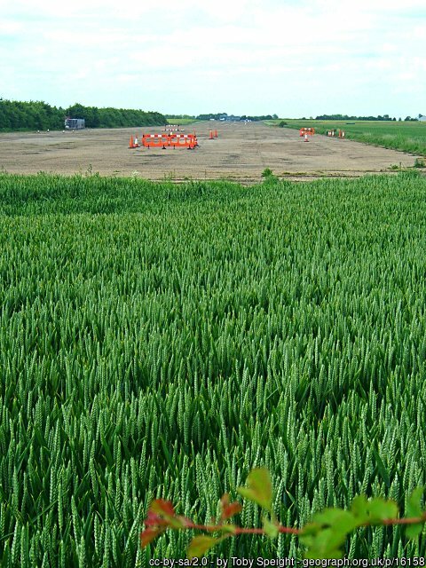
The runway at Bourn, 7 June 2005.
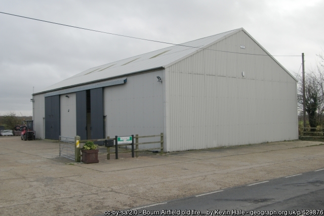
The former fire station at Bourn, 4 December 2007.
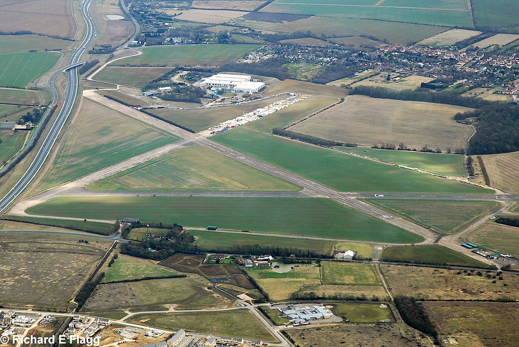
Aerial view of Bourn, 14 March 2009. © Richard Flagg
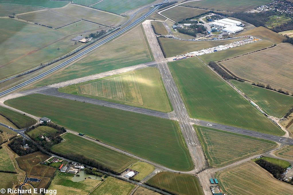
Aerial view of Bourn, 14 March 2009. © Richard Flagg
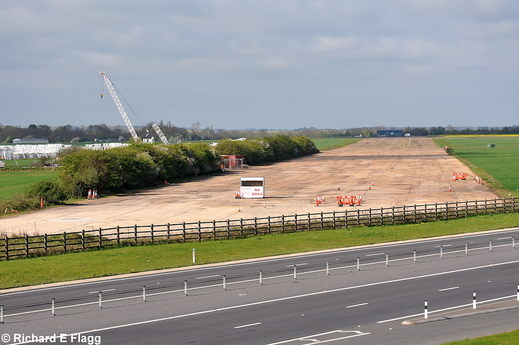
Runway 06:24, looking south-west, 26 April 2010. © Richard Flagg
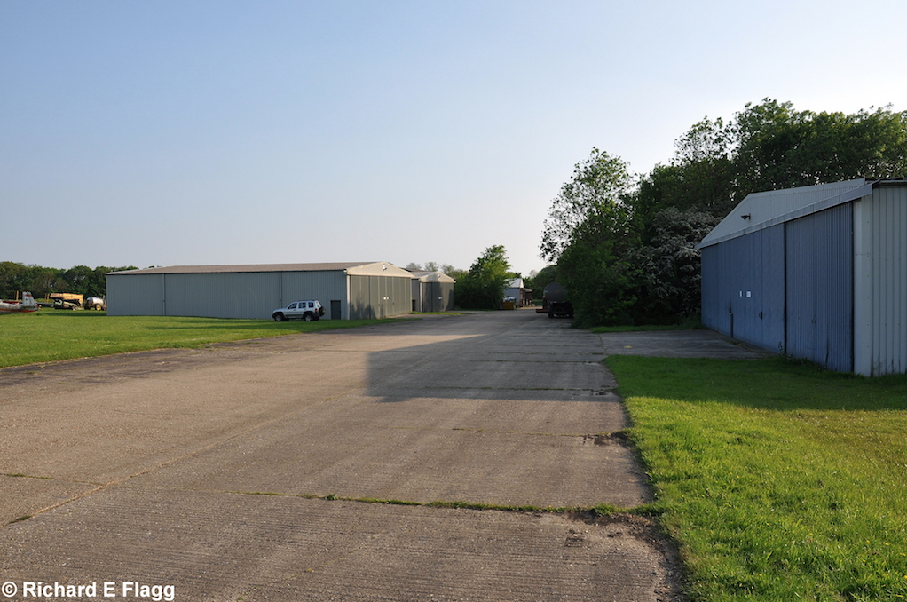
Taxiway at the west of the airfield, looking south west at one of the old dispersals, now where the club hangars are, 18 May 2014. © Richard Flagg
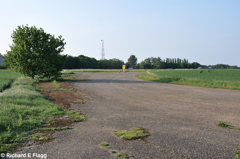
Taxiway at the west of the airfield, looking north from near the runway 06 threshold, 18 May 2014. © Richard Flagg
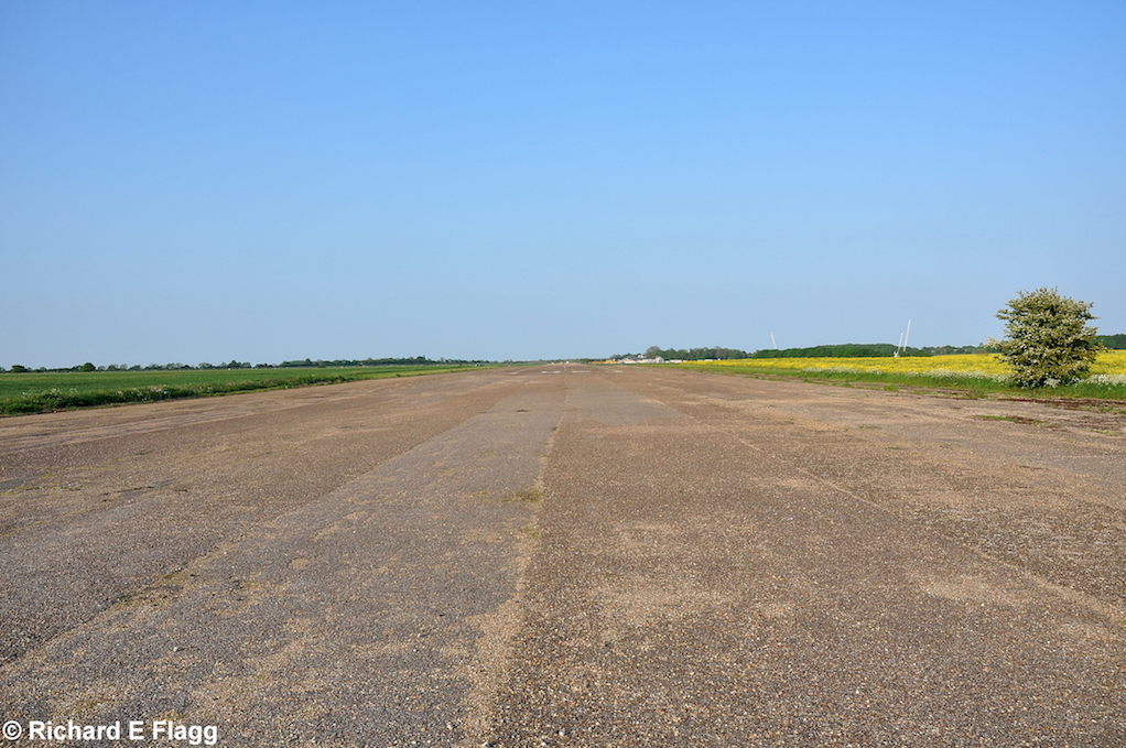
Runway 06:24, looking north-east, 18 May 2014. © Richard Flagg
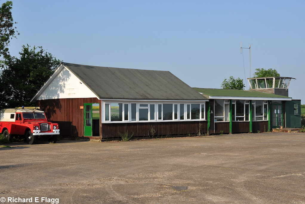
The clubhouse and control tower at Bourn, 18 May 2014. © Richard Flagg
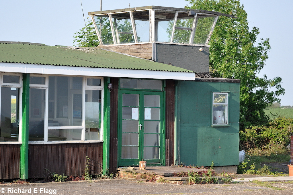
The control tower at Bourn, 18 May 2014. © Richard Flagg
Save Bourn Airfield. Courtesy of Tom Warrior
| Parent(s)/HQ Airfield(s): |